California Wildfire Map for Book
¿Quieres ganar un trabajo como este?
Este cliente recibió 23 diseños gráficos de 10 diseñadores. Eligieron este diseño gráfico de kourosh como el diseño ganador.
Únete gratis Encuentra trabajos de diseño- Garantía
-
 US$110
-
 23 diseños
-
 10 diseñadores
Resumen de Diseño Gráfico
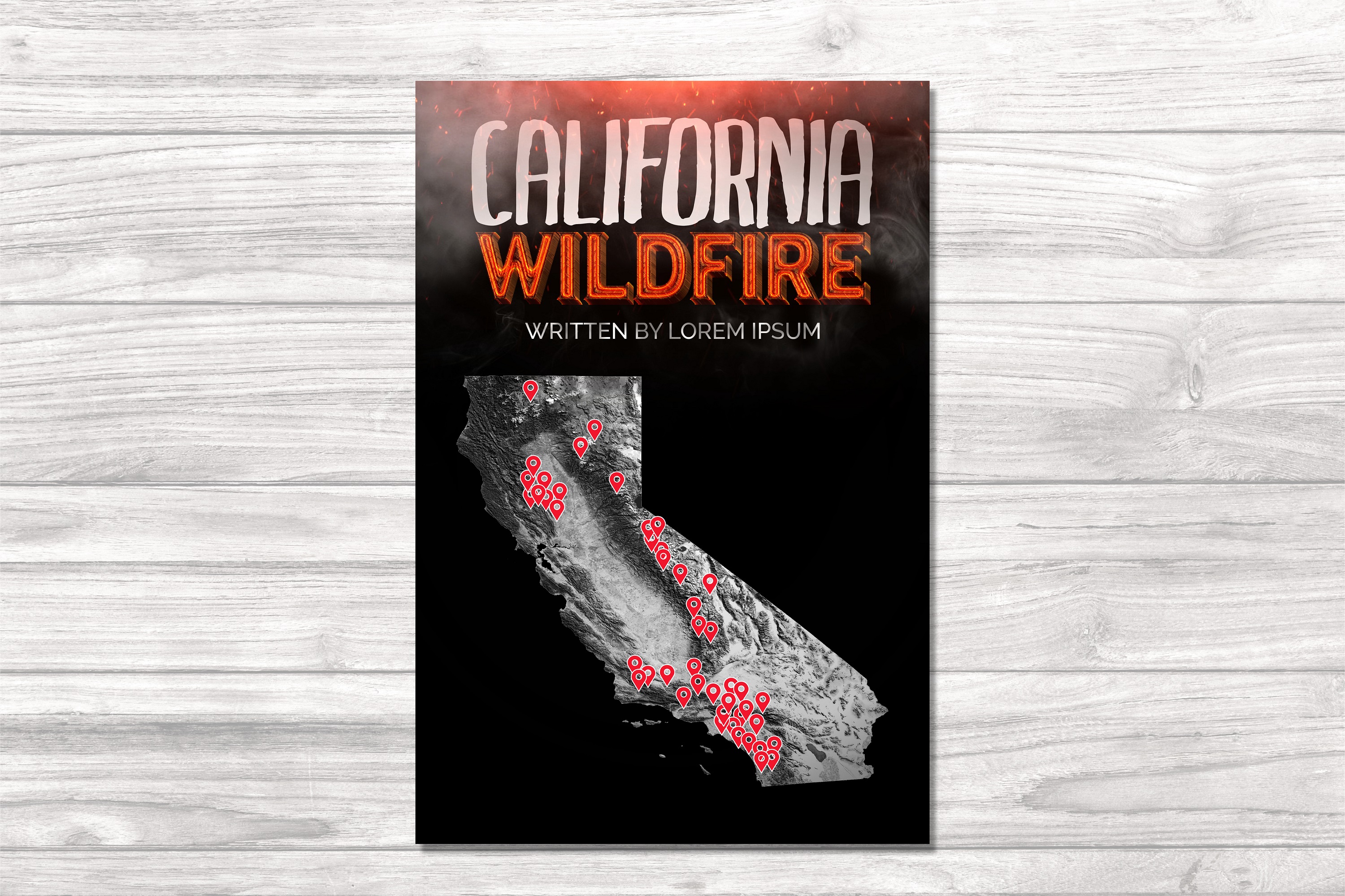
Graphic map outline of California, with pins placed at a few dozen locations. I am a photographer writing a book about wildfires I've photographed. These pins will represent the fires I've covered. I've attached a rough mockup.
Final graphic will probably be printed in grayscale, but if you decide to use color, warmer tones are best. Below is the Google Maps doc I have for logging fire locations, and a *very* bad mockup of a graphic direction...
See this link for the updated map and for reference: https://www.terraflamma.org/map
Should be a vertical image with a fairly standard 2:3 aspect ratio which will fit on a standard hardcover book page. This should also allow the California state outline to fit.
You may use the "Into the Inferno Heat Map, 2012-2020" if you'd like.
Objetivo del mercado(s)
In Book for Reader, Possible online Use as well.
Estilos de fuente para usar
Mira y siente
Cada control deslizante ilustra las características de la marca del cliente y el estilo que debe comunicar el diseño de tu logotipo.
Elegante
Atrevido
Juguetón
Serio
Tradicional
Moderno
Atractivo
Profesional
Femenino
Masculino
Vistoso
Conservador
Económico
De Alta Gama
Requisitos
Debes tener
- Map of California with pins or another object that shows most of the fires that I've pinned on Google Maps. Location does not have to be exact, but should be fairly accurate.
Agradable de tener
- Clean design that shows most of the pins. Geographically accurate.
Some topographical relief features showing California's mountains would be cool. Even if it's just the Sierra Nevadas and SoCal mountains.